Thursday, August 10, 1995

1995 – Queen Charlottes Kayak Trip

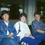
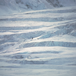
This 2 week trip to the Queen Charlotte Islands (now called Haida Gwaii) was the longest, both in distance and duration, kayak trip we did.  It also planted the seed in Marcia’s and my head about exploring that long coast between Puget Sound and SE Alaska.  There were six people (3 couples) on the trip, Marcia and myself, Craig and Sharon Rowley, and Debbie Wolf and John Wick.  We paddled 2 double (Marcia & I, Debbie & John) and 2 single kayaks (Sharon & Craig).

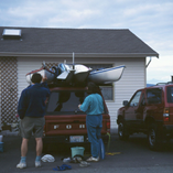
Logistically, it was complex as to get to the put-in point at Raspberry Cove near the south tip of Moresby Island we had to:

  1. Drive 2 vehicles with 4 kayaks to the Tswwassen BC Ferry Terminal
  2. Ferry across to Nanaimo on Vancouver Island
  3. Drive Nanaimo to the Port Hardy BC Ferry Terminal
  4. Ferry 1 vehicle with 4 kayaks to Prince Rupert (1 vehicle was left in a parking lot and 4 of us walked aboard the ferry)
  5. Ferry to Skidegate on Graham Island
  6. Ferry to Alliford Bay on Moresby Island
  7. Drive to Moresby Camp landing (the 4 “footsies” rode in the van of our water taxi service)
  8. Water taxi with kayaks and gear a in large Zodiac (i.e., rigid hull inflatable boat) to Raspberry Cove.

This positioning took 2-1/2 days.  It was pouring down rain when the water taxi dropped us in the afternoon of day 3.  It was then we began to learn the art of erecting tarps over tents and the cook area.

It turned out that the day we landed was the wettest day of our trip.  While overcast and occasionally rainy for the first week, the weather improved and we were in sunshine by the end.

The kayaking was not terribly challenging with only a few long (>3 miles) crossings.  Otherwise it was mostly near shore paddling.  Our take-out/pick-up spot was on Hot Springs Island in Juan Perez Sound after about 10 days of paddling.  The trip home was pretty much the reverse of the trip up.

The trip’s high points were the First Nation ruins at Tanu and Ninstints, the camping in old grow forest (the towering trees and thick moss gives it the feel of a cathedral) and the scenic soak pool on Hot Springs Island.
Tuesday, February 1, 1994

1994 New Zealand

While attending the sea kayak symposium at Port Townsend with our friends Craig & Sharon Rowley, we sat in on a presentation by Mark Hutson about kayaking in the Bay of Islands in New Zealand.  That lead us down the path of putting together a five week trip (at least for Marcia and I) that crammed lots of activities across a good chunk of New Zealand.  The Rowley’s opted for a slightly shorter 3-1/2 week trip.

Our trip started right after Christmas (1993) and heading as fast as 3 connecting flights allow to Christchurch on the south island.  The Rowley’s would join us about 10 days later. 

Sun, scenery and a bike, doesn't get better.While on our own, we did some touristing in Christchurch which we loved but then headed with our backpacking gear to the north end of the south island to do the Heaphy Track, a 48 mile walk that cuts across the NW corner of the south island.  The first day was fine but during the second day, the rain fell heavily.  While we had a tent, I recollect that we stayed in a hut the second night.

The weather was a bit drier the third day and we reached the Heaphy Hut along the Tasman Sea.  We (or at least Kurt) learned the hard way the ferocity of sand flies.  The fourth day brought us to the track’s end (or beginning depend on your direction).  A shuttle took us to a lovely lodge in Karamea.   A bus ride took us to Westport where rains returned in earnest.  We spent two nights at a hostel in Westport than took the train back to Christchurch. 

1994-NZ-083While waiting for the arrival of the Rowley’s, we did a day trip up to Kaikoura where we went on a whale watching trip.  These are sperm whales which feed on the squids living in the underwater canyon that is close off the shore of the Kaikoura peninsula.

Once the Rowley’s arrived, a car was rented and the “adventure” of driving on the left side of the road began.  We headed to Dunedin, south of Christchurch.  We traveled up the Otago Peninsula and stopped at the Royal Albatross Centre.  While there we saw both Royal Albatrosses and the Little Blue Penguins.  The penguins were viewed from quite a distance as they returned from their day of fishing and trudged slowly up a sandy hill side to their burrows.

Marcia among the sheep at Walter Peak Farm across Lake Wakatipu from Queenstown.We next drove to Queenstown where we spent several days doing touristy type things.  It included a visit to the Walter Peak Farm, a day trip to Milford Sound, a jet boat ride up the Dart River and, for Marcia and I (Craig & Sharon opting out), a tandem parasail ride.

Upon our return to Christchurch we flew to Auckland on the north island.  We again rented a car and began a tour of some of the sights on the north island.  Along the way we car camped a couple of nights at a beach on the Coromandel Peninsula before heading to Rotorua and its thermal hot springs.  From there we continued on to the Waitomo for a black water rafting trip.

It was now time to return to Auckland and take a bus up to Paihia in the Bay of Islands where we would start our sea kayak trip.  There were six clients on the trip, one less experienced than the four of us (the Rowleys, Marcia and I) and one more experienced.  Accompanying Mark was his significant other, a kayaking friend and the friend’s daughter.  All were very experienced.

1994-NZ-194The trip was lovely and the weather generally quite nice.  Most of our previous sea kayaking experience had been in protected waters so it was a new experience to be more (but not totally) to ocean swells and surf.  We had some surf landings and the opportunity to take empty kayaks out after camp was established and work on our surfing.  We visited sea caves and paddled in the swells near shore.  It is a thrilling experience to feel your kayak go up and down as the swell builds underneath, before it (the wave and hopefully not you) crashes on to the nearby rocky shore.  After about a week of paddling (distance uncertain), we took out at Matauri Bay about 20 miles (as the crow flies) from our put in.

We spent a couple of nights in Auckland at the after the kayak trip but it is a large city and we were ready to head back by that time.  All in all, the New Zealand trip was a joy and I would gladly visit again.

Wednesday, June 30, 1993

1993 – West Buttress

Marcia organized this climb with 2 other woman, Billie Butterfield and Gayle MacCleary, who had attempted to climb Mt McKinley but failed.  Since everybody knew each other, had considerable climbing experience and all of the necessary gear, the organization was pretty minimal.

The flew onto the glacier in early June and hoped to summit near the solstice.  Their health was good and the weather the usual mixture of good and bad.  They did have to spend several days at the 17,000 high camp waiting for the weather.  Despite some grumbling and noises about turning back, Marcia squashed those thoughts and kept everybody inline until the weather window showed up.  On summit day, everybody made it without drama or injury.

The descent went quickly and they had no wait at the airstrip.  Billie and Marcia went out first followed later by Gayle on the last flight of the day.

Tuesday, June 30, 1992

1992 West Buttress

The 1992 trip was designed to be a “let’s just get it down” kind of climbing trip: a small experienced group, Craig Rowley, Marcia and I, to keep logistics simple; the straightforward and popular West Buttress route to keep route finding simple; and optimum timing, mid to late June, to provide long days and a low climatic probability of severe cold storms.  I had descended the entire West Buttress route in 1981, Craig, Marcia and I had all descended the  route from Denali Pass (18,200) in 1988 and Marcia had ascended the route as far as the fixed lines at 15,000 feet in 1989.  No problems, let’s just get it done!

We applied our experience and moved efficiently right from the landing strip at Kahiltna Base (6,800 feet) on the SE Fork of the Kahiltna Glacier.  Rather than doing a double carry from the airstrip, we took advantage of the downhill section leaving the airstrip and the relatively shallow slope on the lower Kahiltna to do a single carry to our first camp at about 7,000 feet.  Double carries were used from then on.

My previous two Denali climbs had been on rarely used routes so I was concerned that the crowds would be off putting.  As with some many things, enjoyment comes from expectations.  Yes, there were other people on the route, but Denali is big, and while moving I never felt crowded.  Only at camps do you have large collections of people.  The 14,000 foot camp, below the fixed lines up to the buttress, is the most populous and then the crowds just a part of the experience.  The scenery is beautiful at all times.

While we didn’t have any major problems on the trip, the weather was mediocre and Craig and I  suffered a bout of “malaise” at 17,000 waiting for better weather.  Marcia squelched our rebellious thoughts when she won a decisive game of hearts on which the course of the trip hinged.

When the weather finally appeared to be settled enough for a summit bid, Craig opted out so Marcia & I went as a team of two.  We learned a valuable lesson that day, don’t go first!  We were the first team out of high camp and I ended up having to break trail.  Since no one had climbed the route for a couple of days, that wasn’t a trivial effort.  By time we reached the summit ridge at 20,000 (a few hundred vertical feet and a quarter of a mile away), I was exhausted and could go no further.

Reluctantly we turned around.  There had already been 7 fatalities that year on Denali, the most ever to that time, and we did not want to add to the number.  The weather deteriorated significantly as we descended and the visibility made the descent difficult.

1992-W-Butt-CR-15xWe were very glad that Craig was at camp when we arrived as he saw to our needs getting food and hot drinks into us.  He also took our photo when we arrive.  He joked that he now knew how we’d look when we were 60.  Frankly, I think we look a lot better now than we did when arrived back to our 17,000 camp.

We took a few days to get back to airstrip at Kahiltna base where we luxuriated in the warmth and thick air.  The morning after we arrived, we were greeted by thick, dark clouds and a fine gray dust on everything.  Mount Spurr 80 miles west of Anchorage had erupted spreading material in our direction.  After an all hands stomping party on the airstrip to compact and smooth the surface, the air services began flying and we got off the mountain.

Wednesday, January 1, 1992

1991 & 1992 Yellowstone Ski Trips

Our 1991 and 1992 ski trips were both to the same area,
the Canyon area of Yellowstone National Park, so I’ve combined them into one entry.

We had thoroughly enjoyed our 1987 winter trip to Yellowstone but decided in 1991 to start the trip from the North Entrance (Gardiner/Mammoth) rather than the West Entrance (West Yellowstone).  In addition, rather than using the snow coach to take us to Old Faithful we used the snow coach to takes us toward Canyon Village, at the NE corner of the Grand Loop Road.

1993-01-004xAs it turn out, there isn’t (or at least not than) a scheduled run to Canyon Village.  For our 1991 trip, we arranged to get dropped off and picked up at the Norris Junction on the loop road and then ski the 12 miles to Canyon Village.  In 1992, we organized a trip with 7 other people (a total of 9) and hired the snow coach to drop us off at Canyon Village and then pick us up five days later.  The main snow coach used in the park then was the classic Bombardier Snowbus, originally designed in 1939.

1993-01-010xThe dramatic thing about active thermal areas is the substantial amount of rime ice that forms on vegetation and structures on account of the moisture pumped into the air from the thermal features which freezes back out on anything nearby.

1993-01-021xWhile staying at Canyon Village, the Park Service asked that we pitch our tents in the campground area.  Fortunately, the winter warming hut and its restrooms were open 24 hours a day and only a short ski away.  We’d usually spend our evenings in the warming hut, taking advantage of its warmth and light to make the long winter night more pleasant.  Often times the most enjoyable skiing was at night when it is quiet and the white snow reflected whatever meager light came from the sky.

We’d do short trips from our camp at Canyon, skiing trails or roads.  The skiing is delightful because the snow is so dry it was easy to wax the skies for it.  Except for a short period at mid-day, when snowmobilers doing the Grand Loop would come in to refuel, we had the area pretty much to ourselves.  Park Service regulations restricted snowmobiles to the main park roads.  Unless we were skiing the road, to get from one location to another, we never had to contend with the snowmobiles.

To minimize the drain on vacation days, both trips were during the same period, between Christmas and New Years.  The extremely short days were the price we paid for that choice.

Thursday, June 1, 1989

1989 Denali West Buttress

While we successfully traversed Denali during 1988 Muldrow Trip, Marcia did not have a summit to her credit.  After being stuck with 5 guys for nearly 5 weeks, she decided to go the other extreme and organize a trip with 4 woman instead. 

Three of the members, Cindy Luksus, Debbie Wolf and Billie Butterfield were friends of Marcia 1989-W-Butt-004xfrom The Mountaineers.  The fourth member of the trip was Mary who came recommended by John Arnold one of our Muldrow trip mates.  They chose to attempt the West Buttress route (the most popular) in June when the weather is warmer (by Denali standards).

They chose the expedition name of “Seattle Women’s Alpine Team” (aka, SWAT).  There was another all-women’s team on the mountain, “Chicks on Pricks” (the “pricks” being crampons) with whom they were occasionally confused.

They got off on a rocky start when after flying on to the glacier, it turned out that Mary brought along a severe cold.  Not wanting to slow the rest of the team down, Mary flew off the mountain after a few days but not before passing her respiratory ailment on to the others. 

They continued on with the expedition but each of them came down with the “crud”.  Between battling illness and poor weather, they abandoned their trip after 2-1/2 weeks having spent many days at the 14,000 camp and making a carry to the West Buttress at 16,200’.

Friday, May 20, 1988

1988 – Denali, Muldrow Traverse

The 1981 South Buttress traverse of Denali got me keen on seeing lesser visited areas of the mountain.  Even though the Muldrow Glacier on the NE corner of Denali was the only route climbed from 1913, the year of the first ascent, until 1951, the year the West Buttress was climbed, the Muldrow now comes in a distant second in popularity to the West Buttress.

One of the Muldrow’s drawbacks is its longer approach to the glacier before the climb begins. On the West Buttress, climbers land on the SE Fork of the Kahiltna Glacier at 7,200 feet and start from there.  For the Muldrow the start is from Wonder Lake at 2,100 feet and nearly 20 miles distant from the Muldrow Glacier. In addition, the McKinley River has to be crossed.  Depending on the river flow, that crossing is a major challenge.

Recruited for the trip were, besides Marcia & myself, Craig Rowley, Dave Sparks, Al Ellsworth and John Arnold.  To address the longer approach, we allowed for a 4 to 5 week climb and we hired a dog sledder to haul a substantial part of our gear to McGonagall Pass and the glacier.  We solved the McKinley River crossing by leaving early, the second week of April, when the river was frozen.  Since we were traversing the mountain and descending the West Buttress route, thus dodging a river crossing during the breakup or Spring floods.

The climbing was not extremely technical but the route finding through crevasse fields kept us on our toes.  We took way too much food (my fault as I planned out much of the food) which slowed us down.  To keep our pack loads down yet get everything from camp to camp, took multiple trips.  We ended up dumping substantial amounts of food in crevasses along the way.  Even today I can’t look at Danish butter cookies without thinking of the tins that went into crevasses at 16,000 feet.  The good side of our slower pace was that none of us had any major altitude problems on the trip. 

While we failed to summit the peak on account of bad weather on our summit day from the 17,000 camp on the West Buttress, we did complete the traverse and dragged ourselves and oodles of gear over Denali Pass at 18,200 feet.  The climb lasted 34 days, and, with the exception of a National Park Service climbing team returning from Silver Throne (a nearby peak east of Denali), we saw no other climbers until we reached the 17,000 camp on the West Buttress, nearly 4 weeks of solitude.