Tuesday, April 20, 1999

1999 – Grand Staircase-Escalante

Over a number of trips, we had become smitten with the Southwest, especially in their relatively cooler times during Spring and Autumn.  The combination of blue sky, mild temperatures and lovely reddish rocks were a welcome change during the cold and dreary times in the PNW.

Marcia planned this trip as a car camping trip in the Grand Staircase-Escalante National Monument of Southern Utah interspersed with day hikes and short back pack trips.  We left Seattle in early April with our station wagon fully loaded for the two week trip.  Our first hurdle happened to be a late season ground blizzard which closed I-82 near Twin Falls in Idaho.  Fortunately conditions improved quickly and we resumed our drive taking US-93 towards Nevada and an overnight stop at a campground in the Great Basin National Park.  After a cold start the next morning, we took the Lehman Cave tour.

From there it was across the Great Basin of Nevada into Utah ending up at Kodachrome State Park. We picked up the incredibly scenic Utah SR-12 along the way and followed it to the Escalante Petrified Forest State Park.  This and the nearby community was our base for exploring the recently (1996) created Grand Staircase-Escalante National Monument.

Our main access to the area was down the Hole-in-the-Rock Road.  From there we did a day trip to Spooky and Peek-a-Boo Canyon and a multi-day trip to Harris Wash.  Nearby we did the Lower Calf Creek trail.  After our stay there we continued onto Capitol Reef National Park for a short visit.  It was in the town of Boulder just west of Capitol Reef that we heard about the horrific shootings at Columbine High School.

With the exception of the brief snow storm while driving through Idaho, the weather up to this point had been perfect.  But after Capitol Reef a wet front rolled in.  We had intended to stay at the Goblin Valley State Park but as we drove in the rains were pouring down and, only half jokingly, we feared that the hoodoos in the park would dissolve on top of us.  We started our journey home before our memories became tainted by camping in soggy conditions.

Monday, January 5, 1998

1998 – Bryce & Zion in January

For the 1997 Christmas Holiday, Marcia & I flew to Colorado Springs to celebrate with her family. We took our skis and camping gear because after Christmas, we and Marcia’s brother-in-law spent a few nights in huts operated by the 10th Mountain Division Hut Association. After returning to Colorado Springs, we flew to Las Vegas and drove a rental car to Bryce Canyon National Park.

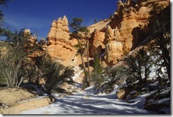
The snow was sparse, so despite having ski equipment, we ended up doing a couple of hikes in the park. We certainly learned to love the gorgeous blue skies contrasting with the colorful rock you frequently find in the SW, even in the winter.

1998-AB-09   1998-AD-21

From Bryce we drove back to Zion National Park visiting both the northwestern Kolob Canyon area and the main Zion Canyon along the Virgin River. There was no snow here (although patchy ice in the north facing portions of Kolob Canyon) so we hiked in trail shoes. We even managed to get ourselves up the Angels Landing trail.

1998-AC-03  1998-BA-14

Tuesday, April 1, 1997

1997 Gates of the Arctic Ski Trip

Marcia and I had such a wonderful time on our 1996 ski trip to Gates of the Arctic National Park that we decided to do another one. We planned a different route, starting in Annatuvuk Pass (as we had in 1996) but ending at Bettles. We also recruited Craig Rowley with whom we had done several other trips with (e.g., 1988 Denali and 1992 Denali).

When our plane arrived in Annatuvuk Pass, it was either below zero or, at best, single digits above. It was also blowing a bit. Nevertheless, we started out south from Annatuvuk Pass aiming for the Inukpasugruk Creek drainage.

1998-AA-01The going was difficult because of the foot or more of unconsolidated snow we were having to break a trail through for ourselves and the sleds. When the sun dropped behind the ridge, the temperature really began to drop, and we made our first camp, perhaps 2 miles from Annatuvuk Pass.

I recall the temperature was 30 below by 5 pm that evening. The gas stove (MSR XGK) struggled against the cold to heat water. The candle lantern would not work because the flame could not melt the wax sufficiently to draw it up the wick. It was easily the coldest night I had ever experienced and showed the limits of the gear we had. The temperature recording device I had only went to 40 below, where it stayed all night long.

The next morning, we warmed the stove fuel bottle for a half-hour inside our sleeping bag before putting it on the stove and making breakfast. It was a unanimous decision to abort the trip at that point. To continue in that cold, with those trail conditions on a route we were unlikely see anyone, we felt was foolish. In retrospect, our 1996 trip might have been a fluke and not typical of spring skiing above the Arctic Circle.

1998-AA-10We headed back to Annatuvuk Pass. Fortunately, the NPS Ranger Station in town was manned and the ranger was kind enough to let us stay in a bunk room used by summer work crews (he probably figured that was easier than rescuing us or doing a report about our deaths).

We salvaged some fun from out trip by flying from Annatuvuk Pass to Bettles for a few days. We stayed at the Bettles Lodge, saw the Northern Lights and Comet Hale-Bopp and skied a few miles to Old Bettles. We joked about the trip being our “weekend ski trip to the Arctic Circle”.

Wednesday, April 24, 1996

1996 – Gates of the Arctic Ski Trip

This has to go down as one of the best trips we ever took.  It started innocently enough, some Alaska Airline travel credits from a cancelled trip (not even sure to where) that would expire in a short time.  The first idea was to fly to somewhere in Alaska where we could see the Northern Lights.  That idea slowly morphed into a full-blow ski trip across the Gates of the Arctic National Park.

The trip involved flying to Anaktuvuk Pass, a native Alaska community north of the Arctic Circle. From there we’d ski about 120 miles, up the Anaktuvuk River, over Ernie Pass, down the Koyukuk River, turn right over Delay & Glacier Passes and out to Wiseman and the haul road that goes to the north slope.  There was even scheduled flights from Fairbanks to Anaktuvuk Pass and Coldfoot (just down the road from Wiseman).  We expected the trip to last about 2 weeks

We had done cold weather camping on Denali and skiing with sleds in Yellowstone but this trip was committing as we didn’t expect to see many, if any, other people along the way.  We did take flares along with us in case we thought we needed to wave down a passing airplane.

One quandary was whether to take a firearm in case of a hungry brown bear along our route.  When Marcia asked a NPS ranger for the park that question, his response was that the bears “would be the least of our problems.”

Despite those ominous words, everything about the trip clicked well.  The scenery was spectacular, the weather about as good as we could ask for, and the route not too difficult to follow.  We saw three sets of people along the way: a group of local hunters on ATV’s on day 2; a group of skiers going the reverse of our route on day 5; and, a two miners on snow machines on day 8.  When we reached Wiseman at the the haul road, Marcia knocked on the door of a cabin that had smoke coming from its chimney and we were invited in for hot tea and able to get a ride the 8 or so miles to Coldfoot which had a motel and an air strip for the flight back to Fairbanks.

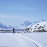
Skiing along the big open valley bottoms, in sun, at a temperature in the low teens with no wind was magical.  It was utterly quiet except for noise of my skis, sled and breathing.  The solitude was so complete it is difficult to describe.

Thursday, August 10, 1995

1995 – Queen Charlottes Kayak Trip

This 2 week trip to the Queen Charlotte Islands (now called Haida Gwaii) was the longest, both in distance and duration, kayak trip we did.  It also planted the seed in Marcia’s and my head about exploring that long coast between Puget Sound and SE Alaska.  There were six people (3 couples) on the trip, Marcia and myself, Craig and Sharon Rowley, and Debbie Wolf and John Wick.  We paddled 2 double (Marcia & I, Debbie & John) and 2 single kayaks (Sharon & Craig).

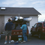
Logistically, it was complex as to get to the put-in point at Raspberry Cove near the south tip of Moresby Island we had to:

  1. Drive 2 vehicles with 4 kayaks to the Tswwassen BC Ferry Terminal
  2. Ferry across to Nanaimo on Vancouver Island
  3. Drive Nanaimo to the Port Hardy BC Ferry Terminal
  4. Ferry 1 vehicle with 4 kayaks to Prince Rupert (1 vehicle was left in a parking lot and 4 of us walked aboard the ferry)
  5. Ferry to Skidegate on Graham Island
  6. Ferry to Alliford Bay on Moresby Island
  7. Drive to Moresby Camp landing (the 4 “footsies” rode in the van of our water taxi service)
  8. Water taxi with kayaks and gear a in large Zodiac (i.e., rigid hull inflatable boat) to Raspberry Cove.

This positioning took 2-1/2 days.  It was pouring down rain when the water taxi dropped us in the afternoon of day 3.  It was then we began to learn the art of erecting tarps over tents and the cook area.

It turned out that the day we landed was the wettest day of our trip.  While overcast and occasionally rainy for the first week, the weather improved and we were in sunshine by the end.

The kayaking was not terribly challenging with only a few long (>3 miles) crossings.  Otherwise it was mostly near shore paddling.  Our take-out/pick-up spot was on Hot Springs Island in Juan Perez Sound after about 10 days of paddling.  The trip home was pretty much the reverse of the trip up.

The trip’s high points were the First Nation ruins at Tanu and Ninstints, the camping in old grow forest (the towering trees and thick moss gives it the feel of a cathedral) and the scenic soak pool on Hot Springs Island.